
SYLLABUS
GS-3: Science and Technology- Developments and their Applications and Effects in Everyday Life; Indigenization of Technology.
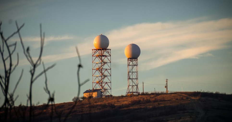
Context: India has significantly expanded its Doppler Weather Radar (DWR) network over the past decade to strengthen its weather monitoring and forecasting capabilities
More on the News
- India’s DWR network has grown from 14 radars in 2014 to around 50 in 2026, representing an increase of over 250%.
- The current network provides coverage to approximately 85–87% of India’s geographical area, significantly improving real-time weather monitoring.
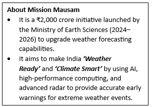
- Under the government’s Mission Mausam initiative, additional radars are planned to further enhance coverage, especially in coastal, mountainous, and disaster-prone regions.
- Future plans aim to expand the network to over 100 radars, enabling near-complete national coverage and improved accuracy in forecasting.
- The expansion is accompanied by advancements in dual-polarization radar technology, which enhances the ability to distinguish between different types of precipitation.
About Doppler Weather Radar (DWR)
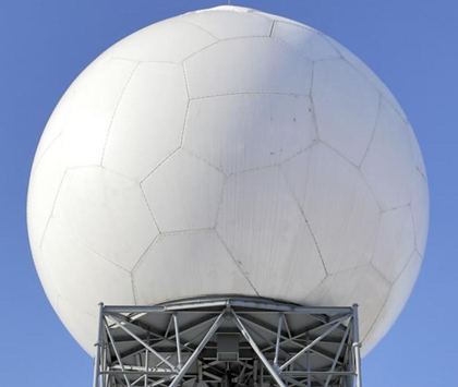
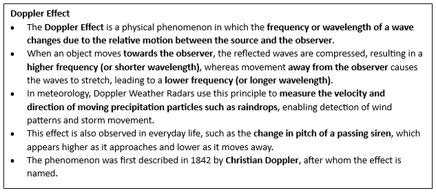
- Doppler Weather Radar is a remote sensing system that uses the Doppler effect to measure the velocity and movement of atmospheric particles such as raindrops, snow, and hail.
- It operates by emitting microwave signals and analysing the frequency shift of the signals reflected back from moving objects.
- Modern DWRs provide high-resolution, real-time data on precipitation, wind patterns, and storm intensity, enabling short-term forecasting or “nowcasting.”
- These radars play a crucial role in tracking cyclones, thunderstorms, and severe weather systems with high precision.
- Types of DWR:
- S-Band Radar: S-band radars operate at longer wavelengths and are particularly effective for long-range detection, making them ideal for tracking large-scale systems such as cyclones.
- C-Band Radar: C-band radars provide a balance between range and resolution and are widely used for general weather monitoring, especially in urban and semi-urban regions.
- X-Band Radar: X-band radars operate at shorter wavelengths and offer high-resolution data over short distances, making them suitable for localized weather monitoring and urban flood forecasting.
Working of DWR
- The radar transmits pulses of electromagnetic waves into the atmosphere, which are reflected back by precipitation particles such as raindrops.
- The time taken for the signal to return helps determine the distance of the weather system, while the frequency shift (Doppler shift) indicates the speed and direction of movement.
- Advanced DWRs use dual-polarization technology, sending signals in both horizontal and vertical orientations to identify the type and shape of precipitation.
- The collected data is processed and integrated with weather models to generate accurate forecasts and early warnings.
Applications of DWR
- Weather Forecasting and Nowcasting: DWRs enable accurate short-term predictions of rainfall, thunderstorms, and severe weather events, improving forecast reliability.
- Disaster Management: They play a critical role in issuing early warnings for cyclones, floods, and lightning, helping reduce loss of life and property.
- Agriculture and Water Management: Farmers benefit from timely weather information for crop planning, irrigation, and pest management, while water authorities use it for reservoir management.
- Aviation and Maritime Safety: DWR data supports safe flight operations and navigation, particularly during adverse weather conditions.
- Urban Planning and Climate Resilience: High-resolution data helps in urban flood management, infrastructure planning, and climate adaptation strategies.
SOURCES
PIB
News on Air
indian express