
SYLLABUS
GS-2: India and its neighbourhood- relations
Context:
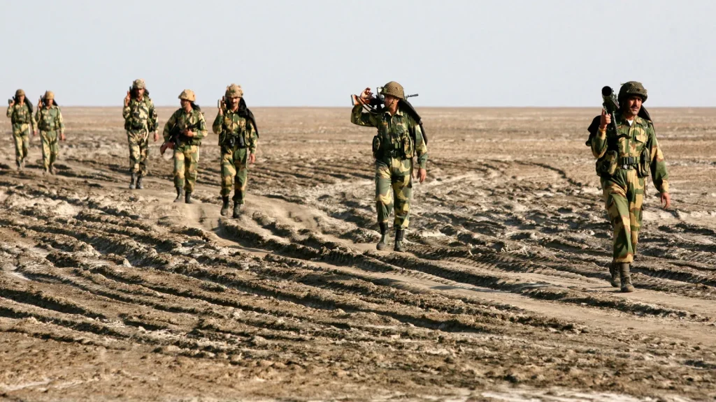
Recently, the Union Defence Minister warned Pakistan that any misadventure or provocation in the Sir Creek region would invite a strong and decisive response from India.
More on the News
- The statement was made at the Bhuj military base, where the Union Defence minister said that any Pakistani misadventure in the Sir Creek area would draw a severe Indian response capable of changing “both history and geography.”
- This warning comes amid heightened India-Pakistan tensions following the Pahalgam attacks and Operation Sindoor, along with rising cross-border activities.
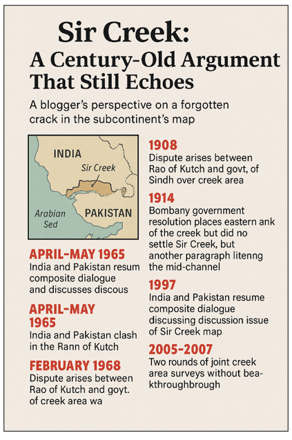
About Sir Creek
It is a 96-km-long tidal estuary located between Kutch in Gujarat (India) and Sindh province (Pakistan).
It is a muddy, uninhabited marshland in the Rann of Kutch that opens into the Arabian Sea.
This creek, originally called Ban Ganga, was renamed Sir Creek after a British official during the colonial period.
- A creek is a narrow piece of water where the sea flows into the land.
About the Sir Creek Dispute
The dispute arises from differing interpretations of colonial-era boundary demarcations between India and Pakistan, further complicated by the shifting course of the Indus River over time.
1908: Dispute arises between Rao of Kutch and the Government of Sindh over the creek area.
1914: Government of Bombay issues a resolution addressing the boundary between Sindh and Kutch, but does not settle the Sir Creek issue completely.
Post-Partition (1947 onwards): The dispute resurfaces following India-Pakistan partition, gaining momentum after the 1965 Indo-Pak war.
1965: Under the 1965 Agreement for Determination of the Border, the dispute is referred to a UN tribunal.
- The tribunal accepts 90% of India’s claims in the Rann of Kutch, granting limited areas to Pakistan.
1968: Report of the Indo-Pakistan Western Boundary Tribunal excludes Sir Creek, leaving the issue unresolved.
1997: India and Pakistan resume dialogue specifically to discuss the Sir Creek map.
2005–2007: Both nations conduct hydrographic surveys and exchange data and charts, but no final agreement is reached.
Significance of Sir Creek
Strategic Importance:
- Sir Creek holds high strategic value for both India and Pakistan.
- Control over this area allows better surveillance and protection of the western coastline.
- The Gulf of Kutch hosts India’s major ports, Mundra and Kandla, increasing the region’s strategic weight.
- Chinese-backed infrastructure projects on the Pakistani side raise concerns over potential dual-use (civilian-to-military) applications.
Counter-Terrorism Concerns:
- Sir Creek is viewed as a potential route for infiltration.
- During the 2008 Mumbai terror attacks, terrorists reportedly used the sea route from Karachi, highlighting the need for enhanced maritime security in this region.
Economic Significance:
- The creek is believed to contain untapped oil and gas reserves.
- For India, particularly energy-import-dependent, exploration could reduce external dependence and strengthen energy security.
Maritime Boundary and EEZs:
- The Sir creek dispute affects the delimitation of the Exclusive Economic Zones (EEZs) in the Arabian Sea.
- A settled boundary would determine the jurisdiction over marine and seabed resources extending up to 200 nautical miles.