
Context:
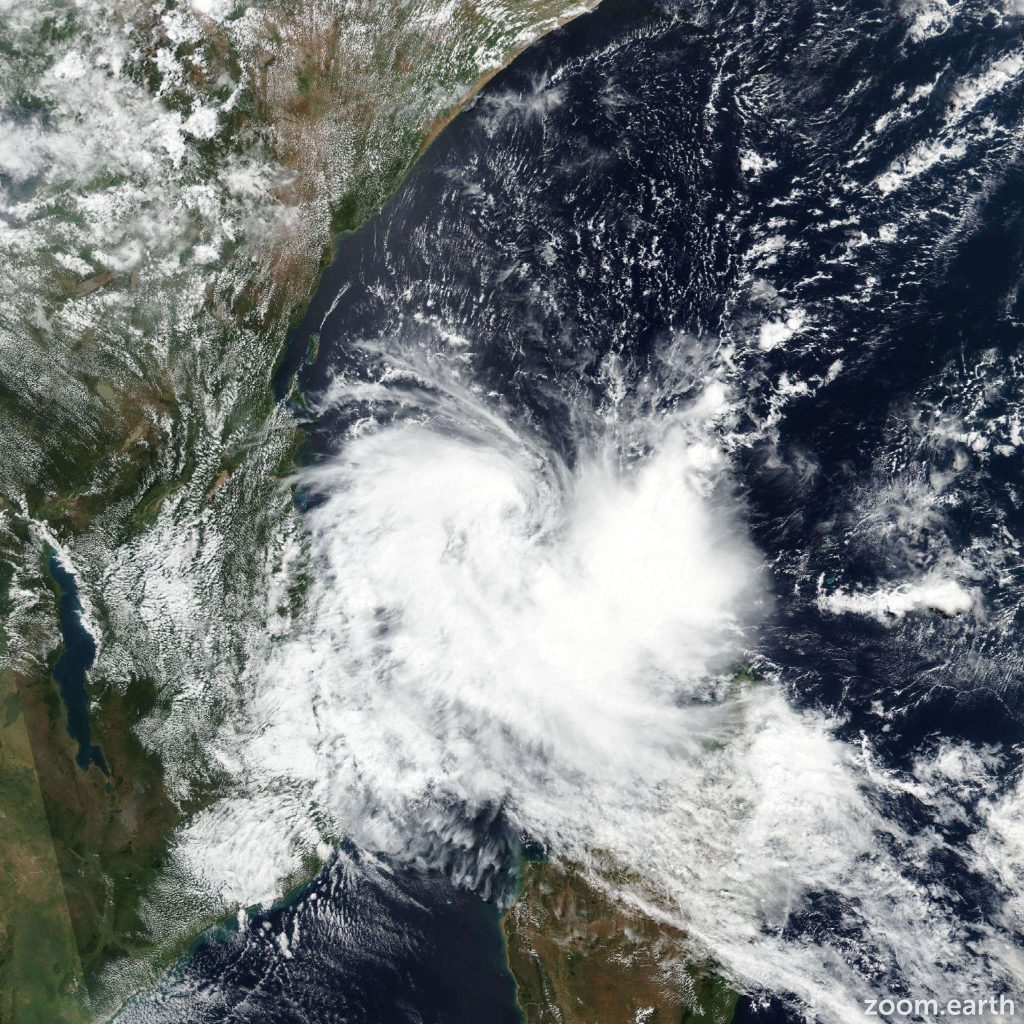
Recently, Cyclone Hidaya made landfall on Mafia Island, Tanzania.
More on the News:
- The cyclone made landfall on Mafia Island, located about 130 kilometres south-southeast of Dar es Salaam, the commercial capital and largest city of Tanzania.
Tropical Cyclones
Formation:
- Tropical cyclones are intense rotating storm systems that form over warm tropical ocean waters (typically above 26°C or 79°F).
- Warm, moist air rises rapidly from the ocean surface, creating a low-pressure zone.
- Surrounding air rushes in to fill the low-pressure zone, also rising and cooling.
- As the air cools, it condenses into clouds, releasing energy that further fuels the rising air and strengthens the storm.
- The Coriolis effect (Earth’s rotation) deflects these winds, causing the storm to rotate.
- In the Atlantic and Eastern Pacific regions, cyclones are commonly referred to as hurricanes. Meanwhile, in the Western North Pacific, they are known as typhoons.

Structure:
- Eye: A central region of calm, clear skies and very low pressure.
- Eyewall: A surrounding ring of intense thunderstorms with very strong winds and heavy precipitation.
- Spiral Rainbands: Outer bands of thunderstorms with heavy rain and strong winds that spiral outward from the eyewall.
Strength Classification:
- Tropical cyclones are categorized based on their sustained wind speeds by various regional organizations like the National Hurricane Center (NHC) in the Atlantic and Northeast Pacific.
- Categories typically range from Tropical Depression (weakest) to Category 5 Hurricane/Super Typhoon (strongest) with increasing wind speeds and potential for damage.
Cyclones in India:
Each year, the North Indian Ocean (the Bay of Bengal and the Arabian Sea) generates approximately 5 to 6 tropical cyclones, contributing around 7% of the world’s total cyclone activity.
Cyclone Management in India:
- National Cyclone Risk Mitigation Project (NCRMP): Supported by the World Bank, this project aims to bolster coastal communities’ preparedness through infrastructure development and construction of cyclone shelters.
- Colour coding of alerts: IMD’s colour-coded system signals cyclone severity, aiding public awareness and preparedness.
- Warning systems: The IMD’s early warning system detects cyclones early, enabling timely evacuation and damage limitation.
- Coastal protection: Measures like mangrove plantations and sea walls mitigate cyclone impact.
- Integrated Coastal Zone Management (ICZM) Project: Enhances coastal resilience through sustainable practices, including vulnerability mapping and livelihood strategies.

About Tanzania
Location and Geography:
- Located in East Africa, bordered by Kenya, Uganda, Rwanda, Burundi, DRC, Zambia, Malawi, Mozambique, and Indian Ocean.
- Home to Mount Kilimanjaro, Africa’s highest peak, and Serengeti National Park.
Capital and Major Cities:
- Capital: Dodoma (Dar es Salaam is largest city and economic center).
- Other major cities: Dar es Salaam, Mwanza, Arusha, Zanzibar City.
Population: Population: 60+ million people.
Official Languages::Swahili and English.
Also Read:
Elected Women Representatives from PRIs participated in CPD57 Side Event