
Syllabus:
GS1: Geographical features and their location-changes in critical geographical features (including water-bodies and ice-caps) and in flora and fauna and the effects of such changes.
Context:
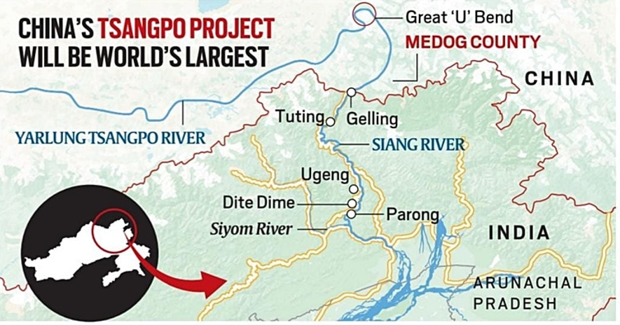
China has formally started the construction of the USD 167.8 billion dam over the Brahmaputra river in Tibet, closer to the Indian border in Arunachal Pradesh.
More on the news:
- The approval for the construction of the world’s largest hydropower project on the Yarlung Tsangpo (or Zangbo) river in Tibet came in December last year.
- The hydropower project, regarded as the biggest infrastructure project in the world, raised concerns in the lower riparian countries, India and Bangladesh.
- The project will consist of five cascade hydropower stations, with a total investment estimated at around 1.2 trillion Yuan (about USD 167.8 billion).
- According to a 2023 report, the hydropower station is expected to generate more than 300 billion kWh of electricity each year, enough to meet the annual needs of over 300 million people.
- It will primarily deliver electricity for external consumption while also addressing local demand in Tibet, which China officially refers to as Xizang.
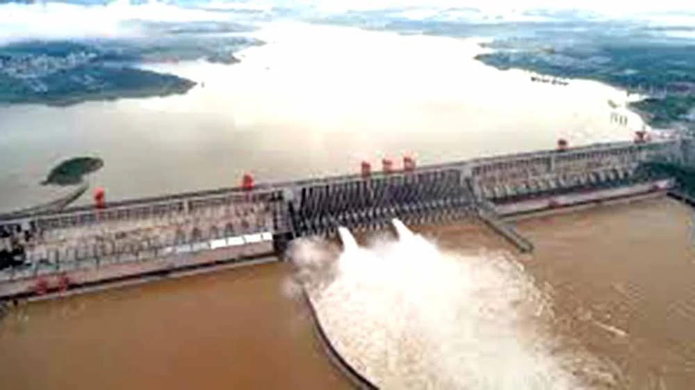
- On completion, the 60,000 MW project will have the capacity to produce three times the amount of electricity as the world’s largest hydro project, the Three Gorges Dam on the Yangtze in central China.
Brahmaputra’s water yield generation in India
- Official Indian estimates suggest that although the portion in India constitutes only 34.2% of the total basin area, it contributes to more than 80% of the Brahmaputra’s yield, making the Tibet Autonomous Region a minor contributor to the basin’s overall yield.
- This is because the Tibetan Plateau is a region of scanty rainfall, of the order of 300 mm annually.
- By contrast, the southern part of the river basin in India receives 2,371 mm of rain on average every year, and very few places receive less than 1,200 mm.
- Also, the Brahmaputra receives a number of tributaries at both its northern and southern banks.
- The yield of the river system is increased significantly by the annual monsoon from June to September.
- Many of the Brahmaputra’s tributaries also receive considerable contributions from snowmelt, mostly in the Indian catchment area.
India’s Concern:
- India, as a lower riparian state with established user rights to the waters of the river, has consistently expressed concerns to China over mega projects on rivers in their territory.
- A major concern in the planned Hydropower Project, is it’s location as the changes in the river’s flow patterns can impact future hydropower projects planned by India on the Siang river, specifically during the lean period and during peak power production.
- Upstream interventions have the potential to affect the river morphology, the flow of silt from the river, crucial for agriculture, can get interrupted, and changes in river flow can impact the local biodiversity.
- Risks of flooding may also arise from intentional or unintentional operation of reservoirs in Tibet, as well as unforeseen events such as dam failure, landslides, or earthquakes.
- This region is also among the world’s most ecologically fragile and earthquake-prone.
Brahmaputra:
- The Brahmaputra, the lifeline of Assam and Arunachal Pradesh, begins in Tibet as Yarlung Tsangpo and flows into India at Gelling in Arunachal Pradesh.
- The river, known as Siang in Arunachal Pradesh, is joined by other tributaries in Assam as it runs across the plains before entering Bangladesh, where it is known as Jamuna.
- The Brahmaputra and its tributaries carry more than 30% of the country’s total water resources potential, and 41% of the total hydropower potential, as per estimates in the CWC-ISRO Brahmaputra Basin Atlas.