
Syllabus
GS 3: Environmental Conservation, pollution and degradation
Context:
Recently, the prime minister of India launched the Aravalli Green Wall project on World Environment Day to combat the degradation of the Aravalli rang.
More on the News
- It will extend the ‘Ek Ped Maa Ke Naam’ campaign.
- Inspired by Africa’s Great Green Wall, it focuses on reforesting 700 km of the Aravallis across 29 districts in Delhi, Haryana, Rajasthan, and Gujarat.
- The Haryana state government will soon begin work to restore 25,000 hectares of damaged forest land.
- The Aravalli Range, known as the “lungs” of the National Capital Region (NCR), plays a vital role in maintaining clean air and ecological balance.
- In Haryana, 24,990.16 hectares of Recorded Forest Area (RFA) land will be restored in the first phase of the project. Of this, 3,852.73 hectares are in Faridabad and 6,063.73 hectares are in Gurgaon.
- The Aravalli range encompasses five other districts in Haryana: Nuh, Mahendragarh, Rewari, Mahendergarh, and Charkhi Dadri.
- In the first phase, 75 water bodies will be restored. The work will begin with five water bodies in each district across the Aravalli landscape.
- The plan has taken inspiration from Africa’s ‘Great Green Wall’ project, which began in 2007. This initiative stretches from Senegal in the west to Djibouti in the east.
- The Aravalli range and its buffer zones cover 3.11 lakh hectares, which is 38.7% of the total area (8.05 lakh hectares) of the districts involved.
- Nuh district has the highest recorded forest area (RFA) at 14,606 hectares.
- Charkhi Dadri is not included in the current phase as it has very little forest land—only 28 hectares.
- The project intends to:
- Replace alien invasive species with native species.
- Restore scrubland, wasteland, degraded forest and water bodies.
- Contribute to India’s commitment under the Paris Climate Agreement by creating a 2.5 billion tonnes carbon sink.
Key findings
- According to the Desertification and Land Degradation Atlas by ISRO, around 97.85 million hectares—about 29.7% of India’s total land area—were degraded during 2018–19.
- The Aravalli region has been marked as a major degraded area to be restored as part of India’s goal to recover 26 million hectares of land.
- An earlier ISRO report from 2016 also showed that more than 50% of the land in Delhi, Gujarat, and Rajasthan was already degraded.
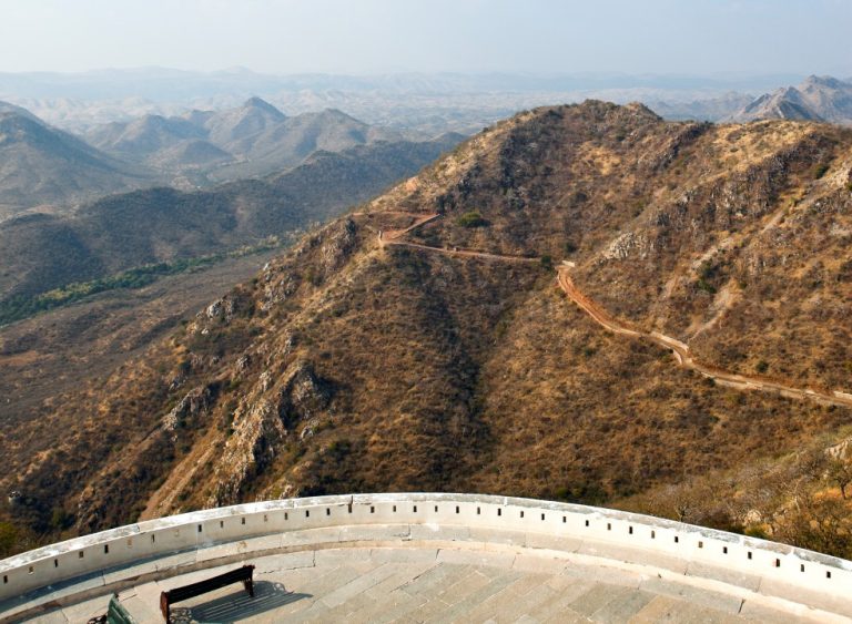
Aravalli Mountains
- It is one of the oldest mountain ranges in the world, dating back to over 3.2 billion years.
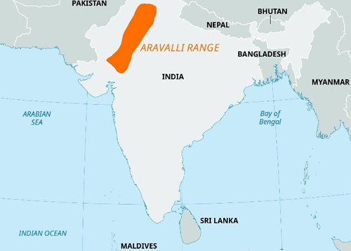
- The Aravalli range stretches from Champaner in southwest Gujarat to northeast Delhi and Haryana.
- It serves as a natural barrier, preventing the spread of sand, hot winds (loo), and dust from the Thar Desert.
- It extends for about 700 km across four Indian states: Delhi, Haryana, Rajasthan, and Gujarat.
- The highest peak: Guru Shikhar (1,722 meters), located in Mount Abu, Rajasthan.
- Rich in minerals: copper, zinc, lead, marble, gold, silver.
- Divided into two main sections in Rajasthan: the higher Sambhar-Sirohi and the ridged Sambhar-Khetri.
Mains Practice question
“Land degradation and desertification pose a serious threat to India’s ecological and economic stability. In this context, discuss the significance of the Aravalli Range in combating desertification.