Context:
Recently, the ISRO chief highlighted that the NISAR satellite is capable of monitoring tectonic movements accurately.
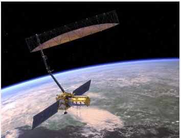
NASA-ISRO Synthetic Aperture Radar (NISAR) satellite
- It is a joint mission of NASA-Indian Space Research Organisation (ISRO), under partnership agreement signed in 2014.
- It will be launch as a low earth observatory to measure Earth’s changing ecosystems, dynamic surfaces, and ice masses.
- It will provide information about biomass, natural hazards, sea level rise, and groundwater, and will support a host of other applications.
- It will globally monitor Earth’s land and ice-covered surfaces every 12 days, both on ascending and descending passes.
NISAR launch
- It is supposed to launch in July but it may go only in October-November this year. It will be launched from India’s Satish Dhawan Space Center in Sriharikota, India, into a near-polar orbit.
- The NISAR spacecraft will launch on an ISRO GSLV-II launch vehicle into a polar sun-synchronous orbit.
NISAR Satellite features:
- NISAR uses a sophisticated information-processing technique known as synthetic aperture radar (SAR) to produce extremely high-resolution images.
- SAR refers to a technique for producing fine-resolution images from a resolution-limited radar system. It requires that the radar be moving in a straight line, either on an airplane or, as in the case of NISAR, orbiting in space.
- It is the first satellite mission to collect radar data in two microwave bandwidth regions, called the L-band and the S-band, to measure changes in our planet’s surface, including movements as small as a centimeter.
- S-band (24 cm wavelength): payload has been made by the ISRO
- L-band (12 cm wavelength): payload made by NASA
- It has a very high swath, because of the large deployable antenna with a 12-metre diameter.
It can monitor the tectonic movements to centimeter accuracy. It can penetrate the ground to a certain depth.

Significance
- It helps to study the water-stressing, climate change-related issues, and agricultural changes through patterns, yield, desertification, and continental movements precisely with respect to annual water cycle movements.

