
SYLLABUS
GS-1: Important Geophysical Phenomena such as earthquakes, Tsunami, Volcanic activity, cyclones, etc.
GS-3: Disaster and Disaster Management.
Context: Recently, researchers at Stanford University have produced the first global map of rare continental mantle earthquakes, marking a major advance in seismology and Earth-interior studies.
More on the News
- The study, published in February 2026 in the journal Science, provides the first systematic global evidence of earthquakes occurring deep within the continental mantle, rather than the Earth’s crust.
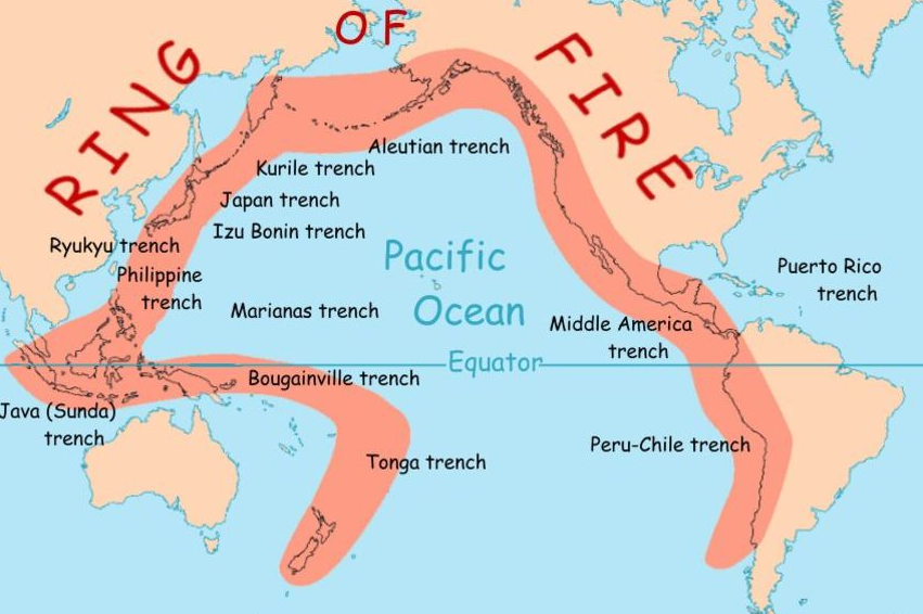
- Traditionally, earthquakes were understood to originate mainly in the cold, brittle crust or in subduction zones where oceanic plates descend into the mantle.
- Confirming mantle earthquakes beneath continental interiors has long been challenging due to limitations in detection techniques and seismic interpretation.
- The new research introduces a waveform-based identification method, enabling scientists to distinguish mantle earthquakes from crustal ones with greater accuracy and global consistency.
Key Findings of the Study
- Global Distribution of Mantle Earthquakes: Continental mantle earthquakes occur worldwide but are spatially clustered rather than uniformly distributed.
- Major concentrations are identified beneath: the Himalayas in southern Asia and the Bering Strait between Asia and North America.
- Depth and Nature of Mantle Earthquakes: Unlike typical crustal quakes (≈10–29 km depth), Mantle earthquakes occur far deeper, sometimes more than 80 km below the Moho (Mohorovičić discontinuity), the boundary separating crust and mantle.
- New Identification Method: The researchers developed a method that compares two seismic waves: Sn waves, which travel through the top of the mantle, and Lg waves, which travel efficiently through the crust.
- A strong Sn relative to Lg signal indicates a mantle origin, allowing scientists to distinguish mantle from crustal earthquakes using waveforms alone.
- Using this method, researchers analysed over 46,000 earthquakes (since 1990) and confirmed 459 continental mantle earthquakes.
Significance of the Findings
- New Window into Earth’s Interior: The Findings provide direct global evidence of seismic activity within the continental mantle, reshaping long-held assumptions in geophysics.
- It offers a new window into crust–mantle interactions, helping scientists understand how Earth’s layers function as an integrated system.
- Advancing Earthquake Science: Although mantle earthquakes are too deep to cause severe surface damage, studying them can help clarify how stress is transferred between the crust and mantle, which in turn can refine models of earthquake initiation in all layers.
- Guiding Future Research and Monitoring: Identified clusters beneath the Himalayas, Bering Strait and other regions highlight priority areas for denser seismic networks and focused geophysical studies.
- The new waveform-based detection approach will enable expansion of global seismic monitoring, especially in remote regions like the Tibetan Plateau.
About Earthquakes
- Earthquakes are sudden releases of energy within the Earth that generate seismic waves, usually caused by tectonic plate movements, faulting, or volcanic processes.
- Hypocenter/focus: It is the location below the Earth’s surface where the earthquake occurs.
- Epicentre: It is the location directly above it on the surface of the earth.
- Earthquakes are recorded by instruments called seismographs. The recording they make is called a seismogram.
- An earthquake’s destructive force depends not only on its strength but also on location, distance from the epicentre, and depth. Shallow quakes generally tend to be more damaging than deeper quakes.
- The earthquakes are divided into the following three zones based on depth of focus:
- Shallow Earthquakes: Focus is less than 70 km deep.
- Intermediate Earthquakes: Have a focus 70 – 300 km deep.
- Deep Earthquakes: Have a focus 300 – 700 km deep.
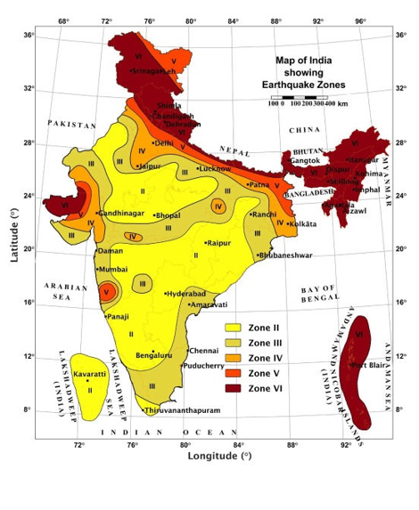
New Seismic Zonation Map
- Recently, the Bureau of Indian Standards released an updated seismic-hazard map of India by revising the Earthquake Design Code, 2025.
- The new map is intended to guide building codes, infrastructure design, urban planning and disaster preparedness, especially in rapidly urbanising and seismically active regions.
- Key Features of the Updated Map:
- A new category, Seismic Zone VI, has been created as the highest hazard class. Under it, the entire Himalayan arc is now placed in Zone VI, reflecting its very high tectonic activity and unruptured fault segments.
- Earlier, India was divided into four zones: II (low), III (moderate), IV (high) and V (very high).
- Under the revised map, about 61% of India’s land area now falls under moderate to high hazard zones (up from roughly 59%), and around three-quarters of the population lives in seismically active regions.
- A new category, Seismic Zone VI, has been created as the highest hazard class. Under it, the entire Himalayan arc is now placed in Zone VI, reflecting its very high tectonic activity and unruptured fault segments.
sources:
Downtoearth
Phys
Thebrighterside