
Syllabus:
GS3: Awareness in the fields of IT, Space, Computers, robotics, nano-technology, bio-technology and issues relating to intellectual property rights.
Context:
The NASA-ISRO NISAR satellite was recently launched aboard a GSLV Mk-II from Sriharikota, Andhra Pradesh.
More on the News
- India and the US marked their maiden space collaboration with the successful flight of a GSLV rocket that placed NISAR in a precise orbit.
- ISRO’s GSLV F-16 injected the Synthetic Aperture Radar satellite into the intended Sun Synchronous Polar Orbit (SSPO), after a flight of about 19 minutes and around 745 km.
- The GSLV-F16 marks the 18th flight of India’s Geosynchronous Satellite Launch Vehicle and the 9th operational flight with an indigenous cryogenic stage.
- This mission is the first GSLV launch to achieve a Sun-Synchronous Polar Orbit.
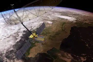
NISAR
- The satellite’s successful launch will be a major milestone in Earth observation due to its dual L-band and S-band radar systems.
- L-Band radar: NASA’s L-band radar detects ground deformation beneath forests and soil. It uses higher wavelength microwaves.
- S-Band radar: ISRO’s S-band radar tracks surface changes like crops, biomass and water levels.
- NISAR will aid in disaster management and can penetrate fog, dense clouds and ice layers.
- The satellite covers the entire Earth every 12 days, providing about 2.5 coverages per month and 10 coverages in 120 days.
- The planned mission lifetime is three years, although its design lifetime is at least five years.
- Notably, the mission’s data policy entails that the data NISAR produces will be freely available to all users (typically) within a few hours.
Sun-synchronous Polar orbit (SSPO)
- It is also known as a Helio synchronous orbit.
- It is a particular kind of polar orbit in which satellites are in sync with the Sun.
- It is an orbit where a satellite passes over any given point on a planet’s surface at the same local mean solar time each day.
Objective of the Mission
- It is designed to study changes on the Earth’s surface in fine detail, covering earthquakes, volcanoes, ecosystems, ice sheets, farmland, floods and landslides.
- This will enable us to monitor seasonal changes, including forest dynamics, mountain shifts and glacier movements in regions like the Himalayas and Antarctica.
- Satellites is objected to provide critical information by taking snapshots of changes from space, helping scientists, governments and relief agencies prepare for, respond to or study them.
Synthetic aperture radar (SAR)
- SAR is a way to make sharp pictures even when it’s dark or cloudy.
- Instead of using visible light like a regular camera, SAR systems send out microwave pulses and record the echoes that bounce back from the ground, ocean, ice or buildings.
- Then, clever signal processing turns those echoes into detailed images.
Working of the NISAR
- After launch, NISAR will enter a sun-synchronous polar orbit at 747 km altitude and will use radar waves, not images, to measure surface changes by timing signal returns and phase shifts.
- Synthetic Aperture Radar (SAR) simulates a large antenna by combining radar echoes collected as the satellite moves, allowing it to capture high-resolution data without a physically large antenna.
- Although NISAR will operate globally at L band, ISRO has reserved routine, planned acquisitions with the S band SAR over India.
- Both instruments will observe a swath of 242 km. L-SAR will handle frequencies of 1.25 GHz with a spatial resolution of 3 – 48 m while S-SAR will handle frequencies of 3.2 GHz with a resolution of 3 – 24 m.
- It has been achieved by using SweepSAR technology that digitally steers beams on return, enabling wide coverage without losing resolution.
- NISAR will scan each area every 12 days with 3–10 m resolution and centimetre-level vertical accuracy, using a large 12 m mesh antenna which is ideal for detecting land subsidence and surface changes.