

Context:
A University of Waterloo-led study revealed that climate change is increasing the potential for algal blooms in the UK’s River Thames, despite a four-decade decline in phosphorus loads.
Key Findings of Study
- Phosphorus loads in the River Thames have decreased by approximately 80% over the past 40 years due to improved wastewater treatment and agricultural practices.
- Rising river temperatures, driven by climate change, are increasing the risk of:
- Spring diatom blooms
- Summer cyanobacterial blooms
- Algal blooms can impact river health by:
- Shading out and suffocating aquatic life
- Depleting oxygen levels in the water during decomposition
- Exposing rivers to potentially toxic cyanobacteria.
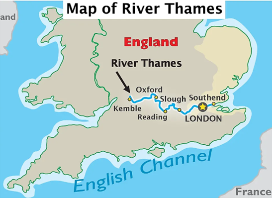
About Thames River
- The River Thames is 346 km long, flowing through southern England.
- It starts at Thames Head in the Cotswold Hills, Gloucestershire County.
- It is the longest river in England and the second longest in the UK, after the River Severn.
- The river passes through popular cities, including London, Reading, Henley-on-Thames, Windsor, and Oxford.
- In Oxford, the river is also called the Isis River.
- The Thames flows into the North Sea via the Thames Estuary.
- Its basin covers an area of approximately 16,130 km2 and provides two-thirds of London’s drinking water.
- The River Thames is divided into tidal and non-tidal sections.
- The tidal section, known as the Tideway, extends from Teddington Lock to the North Sea.
- The non-tidal section stretches from the river’s origin to Teddington Lock and is fed by 38 tributaries.
- The main tributaries of the River Thames are Lea, Leach, Churn, Coln, Windrush, Kennet, Evenlode, Ock, and Loddon.